Walks & Nature
Clifftop trails, ancient rainforest & 620 hectares of pristine national park on your doorstep
Clifftop trails, ancient rainforest & 620 hectares of pristine national park on your doorstep
Spanning 620 hectares across two sections, Wyrrabalong National Park protects the last patch of coastal rainforest on the Central Coast. From Bateau Bay south to Forresters Beach and again from Norah Head to Budgewoi, this precious corridor of bushland is wedged between suburbia and the Pacific Ocean.
The park is a biodiversity hotspot, home to 144 bird species, 29 mammal species, 19 reptile species and 8 amphibian species. Whether you have 30 minutes or a full day, there is a trail and a lookout waiting for you.
Park hours: 5:30 am – 8:00 pm during daylight saving · 5:30 am – 6:00 pm rest of year. No entry fees apply.
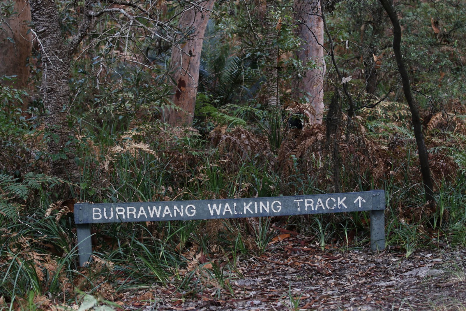
The crown jewel of Wyrrabalong National Park — a stunning clifftop trail that connects Bateau Bay Beach to Wyrrabalong Lookout through blackbutt forest, spotted gum woodland and groves of coastal banksia.
One way (6 km return)
Moderate — some steep sections
One way / return with stops
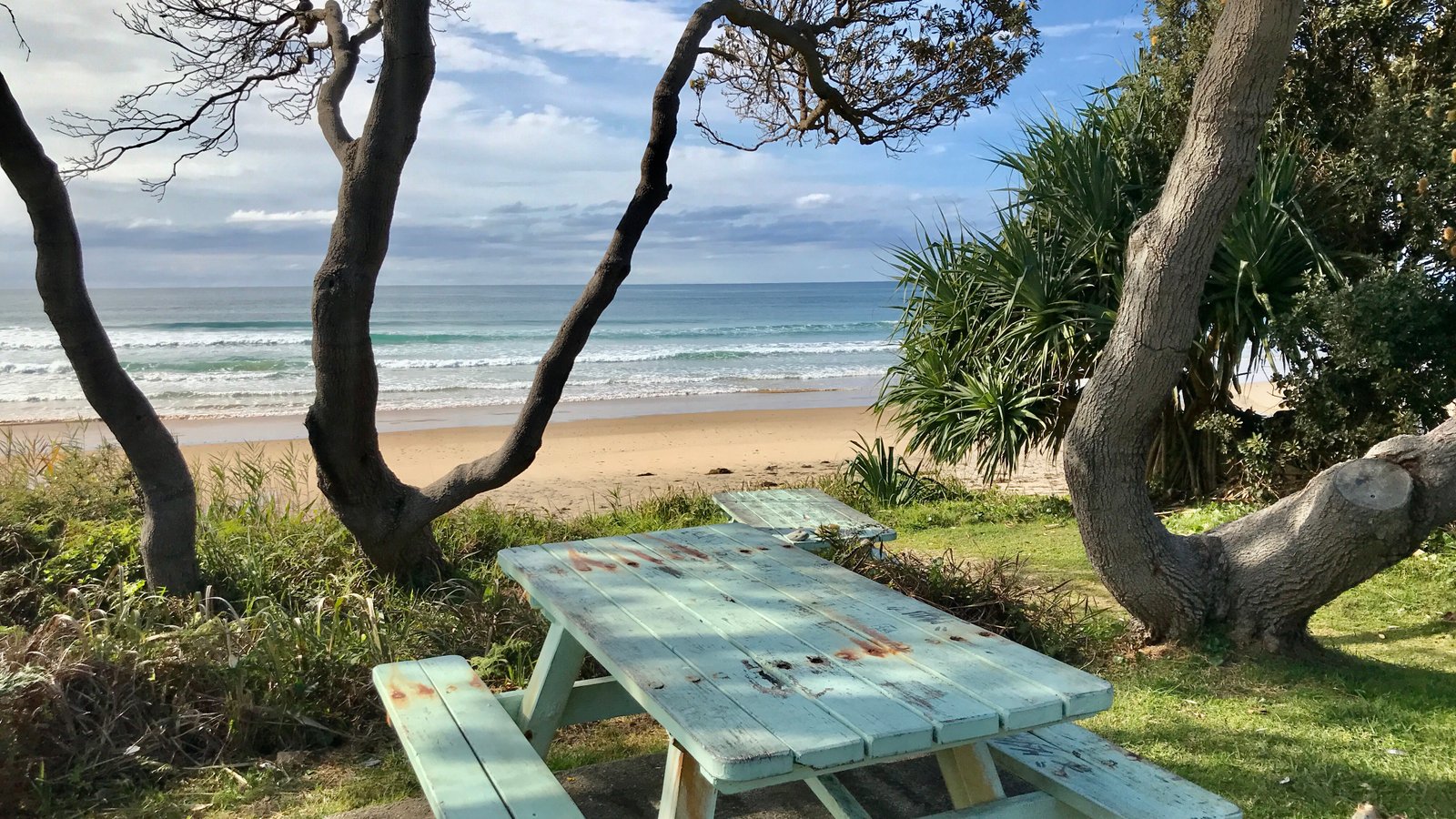
Begin at the picnic area car park off Bateau Bay Road. Free parking, BBQ facilities and toilets available. The trailhead is clearly signposted at the southern end of the picnic area.
The track climbs steadily through blackbutt and spotted gum forest. Watch for lyrebirds scratching through leaf litter and honeyeaters feeding on banksia blooms. Ocean glimpses appear through the canopy as you gain elevation.
Roughly the halfway point and the perfect spot to rest. Sweeping 180-degree ocean panoramas open up from the recently upgraded viewing terraces. In winter, scan the horizon for humpback whale spouts. Free parking also accessible from Hilltop Street if starting here.
The track narrows as it continues along the cliff edge, weaving between wind-sculpted banksias and grass trees. Keep an eye out for sea eagles soaring on the thermals below. The gradient increases toward the southern end.
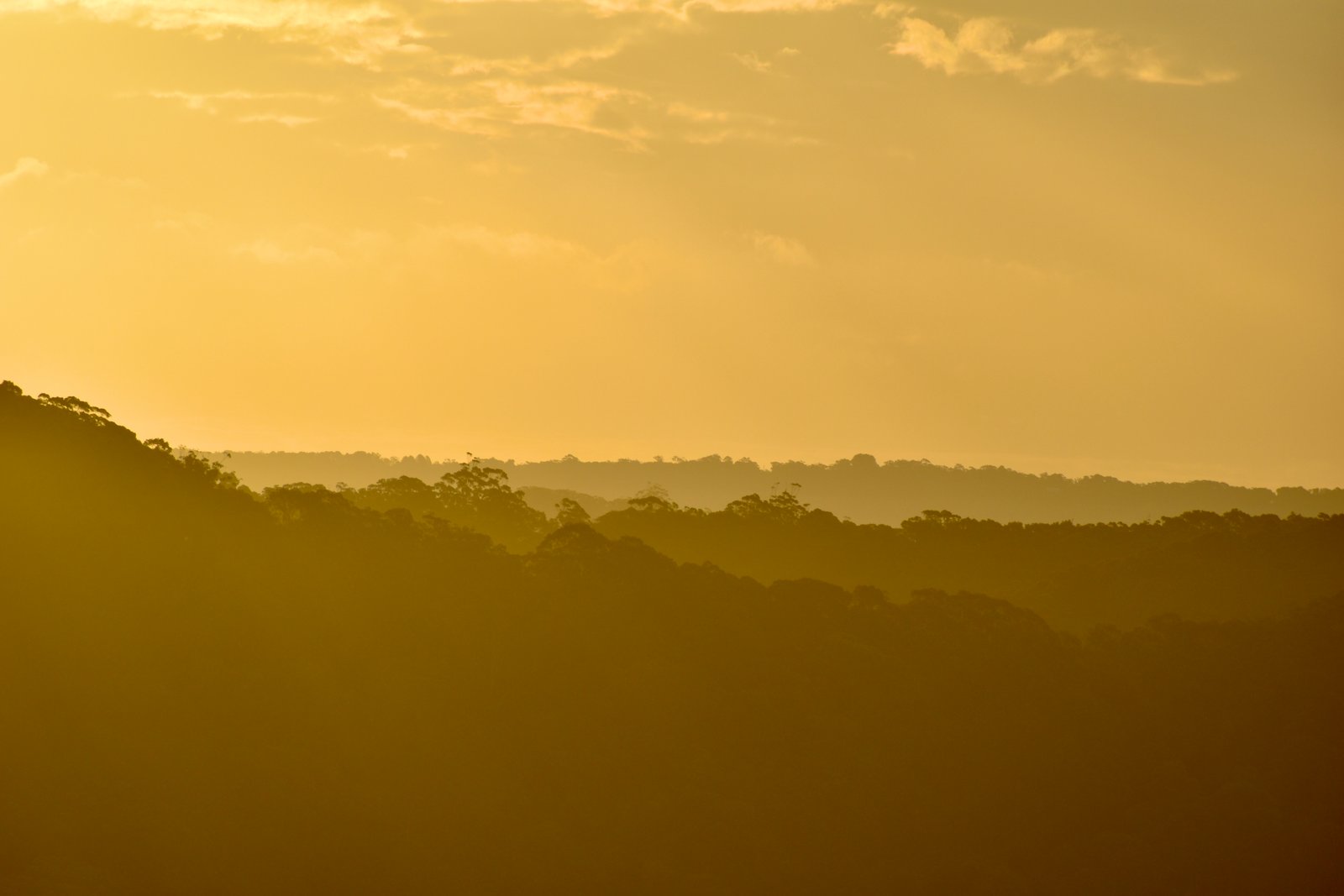
The track culminates at the highest coastal point between Sydney and Newcastle. Panoramic views stretch from Forresters Beach to Terrigal and beyond. Return the way you came, or arrange a car shuttle at the Crackneck end.
Start at Bateau Bay Beach and walk south. The views build progressively — each lookout more spectacular than the last — culminating in the jaw-dropping 130-metre panorama at Wyrrabalong Lookout. Walking north means you see the best view first and spend the rest of the walk looking at what you have already seen.
Experienced walkers can tackle the 9.1 km Grade 5 rock-hopping circuit that follows the base of the cliffs at low tide before climbing back up to the clifftop track. This route is untracked, involves scrambling over boulders and rock shelves, and should only be attempted at low tide with proper footwear. Check tide times before you go and allow 4–5 hours.
Perched on the clifftops of Wyrrabalong National Park, Crackneck Lookout is the most accessible and most visited viewpoint on this stretch of coast. Drive straight to the top via Hilltop Street, where 55 free parking spaces make this one of the easiest lookouts to reach on the entire Central Coast.
A recent upgrade by Goanna Services, an Aboriginal-owned contractor working with NPWS, has transformed the site with new viewing terraces, sandstone seating and wheelchair-friendly pathways — making the panoramic views accessible to everyone.
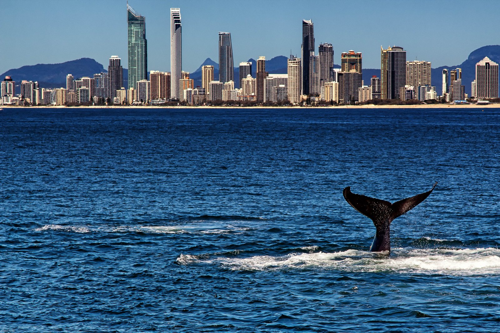
Crackneck is the Central Coast's premier whale-watching spot from May to August, when humpback whales migrate north along the coast. It also serves as a popular hang gliding and paragliding launch site, so do not be surprised if you see colourful wings soaring overhead.
Note: There are no toilet facilities at Crackneck Lookout. The nearest toilets are at Bateau Bay Beach picnic area, approximately 1.5 km north along the Coast Walking Track.
At 130 metres above sea level, Wyrrabalong Lookout is the highest coastal point between Sydney and Newcastle. The panoramic views extend from Forresters Beach in the south to Wamberal and Terrigal beaches stretching northward along the coast.
Above sea level
Beaches stretching along the coastline
Dramatic cliffs and pristine shoreline
Wyrrabalong Lookout is the southern terminus of the Coast Walking Track. There is no direct vehicle access — you will need to walk in from either Bateau Bay Beach (3 km) or Crackneck Lookout (1.5 km). The effort is well worth the reward.
Wyrrabalong National Park is a living sanctuary where rare birds, migrating whales and seasonal wildflowers create year-round nature encounters.
144 Species
With 144 recorded bird species, Wyrrabalong is one of the richest birding sites on the Central Coast. Look for white-bellied sea eagles soaring above the cliffs, superb lyrebirds in the gullies, and colourful eastern rosellas and king parrots through the canopy. Dawn and dusk are the best times, with the Lillypilly Loop Trail in the northern section particularly productive.
 May – Aug
Every year from May to August, humpback whales migrate north along the coast, often passing within a few hundred metres of Crackneck Lookout. July is peak season — bring binoculars and patience. On a good day you might spot multiple pods breaching, tail-slapping and spy-hopping. Whales return southward from September to November with their calves.
 Spring
From September to November, the coastal heathlands burst into colour. Look for the iconic flannel flowers with their soft, felt-like petals, delicate ground orchids hiding among the leaf litter, and prolific banksias attracting honeyeaters. The Coast Walking Track and Red Gum Trail in the northern section offer the best wildflower walks.
The northern section of Wyrrabalong National Park, between Norah Head and Budgewoi, offers quieter trails through a different landscape of littoral rainforest and red gum woodland.
A gentle loop through lush littoral rainforest — the remnant pocket of coastal rainforest that makes Wyrrabalong so ecologically significant. The canopy closes in overhead, creating a cool, shaded walk even on hot days. Interpretive signs explain the unique plant communities. Excellent for bird watching at dawn, particularly for lyrebirds, whipbirds and wonga pigeons.
Access: Signposted off Wilfred Barrett Drive, between Norah Head and Budgewoi.
Named for the impressive forest red gums that dominate the canopy, this short trail winds through open woodland with a seasonal understorey of wildflowers. In spring, flannel flowers and ground orchids carpet the forest floor. The trail connects to the Lillypilly Loop, so you can combine both for a longer morning walk of around 3.5 km.
Access: Shared trailhead with Lillypilly Loop off Wilfred Barrett Drive.
Everything you need to know before hitting the trails in Wyrrabalong National Park.